Agoura Hills, California
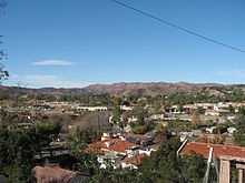
City in California, United StatesAgoura Hills is a city situated in the Santa Monica Mountains region of Los Angeles County, California, United States. With a population of 20,330 as of the 2010 census, which decreased to 20,299 in 2020. Agoura Hills lies in the eastern Conejo Valley, nestled between the Simi Hills and the Santa Monica Mountains. Located 35 miles (56 km) northwest of Downtown Los Angeles and less than 10 miles (16 km) west of the Los Angeles city limits at Woodland Hills, Agoura Hills is bordered by Bell Canyon and Ventura County. Neighboring communities include Calabasas, Oak Park, and Westlake Village, while the unincorporated area of Agoura sits adjacent.
Read article
Top Questions
AI generatedMore questions
Nearby Places

Oak Park, California
Place in California, United States

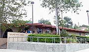
Agoura High School
Public school in Agoura Hills, California, United States
Indian Hills High School (Agoura Hills, California)
School in Agoura Hills, CA

Agoura, California
Unincorporated community in California, United States
Oak Park High School (California)
Public secondary school in Oak Park, CA, United States
Wallis Annenberg Wildlife Crossing
Wildlife overpass spanning US Route 101 in Ventura County, California
Valley Oaks Memorial Park
Cemetery, mortuary and crematory in Westlake Village, California
Timothy Verne Perryman
American missing person from Los Angeles


